
The Port of Truro is 2,500 acres in size and has a significant number of leisure moorings together with visitor’s pontoons and quays. The entire Fal estuary holds approximately 4,500 moorings, 1500 of which are located within the Port of Truro.
History
For centuries, The Port of Truro has had a major influence on the fortunes of the city. From the early 13th Century onwards, tin production in Cornwall increased dramatically.
It was known that the Phoenician traders who brought cloth and other commodities to Cornwall and took away tin ore visited the port of Truro. Similarly, the Romans occupied sites on the banks of the Fal and there is evidence to show that they dredged for oysters in the Fal Estuary. It is on record that King John in about the year 1200 gave the Mayor of Truro jurisdiction over the whole of the Truro River and Fal Estuary, which included the whole of the Falmouth Harbour. Unfortunately, the citizens of Truro backed the losing Parliamentary cause in the Civil War, for which their punishment was a reduction in their customs income resulting from a new restriction in the port boundaries. In addition, Charles II gave a new Customs House to Falmouth.
This division in the administration of the Port and the resultant loss of income caused quite a furore in Truro at that time. It became necessary in 1703, during the reign of Queen Anne, to set up a commission to properly identify the new boundary.
This was finally fixed in 1709 as being a line joining Messack Point on the north side of the St Just inlet on the east bank of the Carrick Roads and Penarrow Point on the west bank just below Mylor. These points still mark the current southern port limits and are identified by each having a granite pillar with the date and TC (Truro Corporation) engraved upon them.
By the 17th Century a much wider range of goods was passing through the port and it was also handling nearly half of Cornwall’s copper exports, while also dealing with imports of timber, coal and other goods.
In the 18th Century, smelting works for tin were established at Newham and the period from 1730 to 1850 would prove to be a golden age for commerce and industry in Truro. During this period there were as many as sixty cargo ships using Newham as their home port. It was around this time that Lighterage Quay became known as Dynamite Quay: explosives from Nobel’s factory in Perranporth were loaded on to ships there – having first been transported through the centre of Truro!
From 1840, passenger boats started operating between Truro and Falmouth and in 1855 the first railway station opened in Newham. This gave a further boost to trade. Merchants could unload their goods on the banks of the river at Newham and Malpas and send them all over the country by train. For the next 100 years, the Newham Line carried cargo the three miles to the main railway line, until Newham Station was finally closed in 1965, following the Beeching Report. The freight line finally closed completely in 1971.
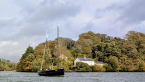
The River Fal lay up moorings, within the Port of Truro, have hosted many ships over the years and continue to this day.
Recreational
Moorings
There are 1,500 moorings within the Port of Truro, these consists of deep water and tidal moorings. We also have approximately 150 beach berths at Malpas Road and Sunny Corner in Truro.
Local clubs, associations and businesses are encouraged to take out a lease of the seabed in order to run their moorings themselves. The club or association gain through being able to charge their own members for the moorings (which include club fees) and enables them to have some security and control over their own particular mooring area.
Clubs benefiting from such leases include:
- Mylor Yacht Club
- Restronguet Sailing Club
- Truro Boat Owners Association
There is currently a waiting list.
Visitors Moorings
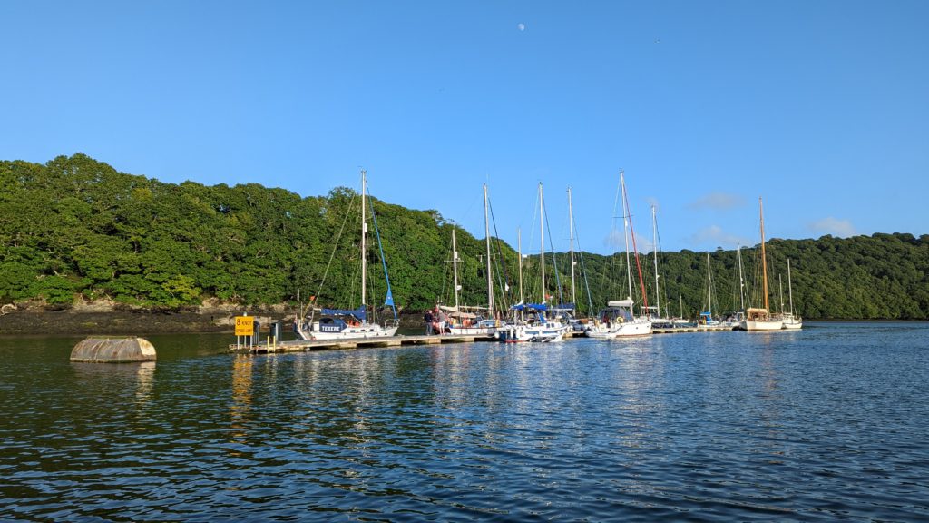
A variety of visitor moorings are available, together with sheltered anchorages. There are four detached visitors’ pontoons on the river, these can take vessels up to 18m. Our Marina at Malpas offers short term visitor moorings for boats or tenders.
The Upper Quays in Truro have electricity and telephone points, basic WC and shower facilities, water and waste disposal. These are available both for short term casual visitors and long term stays.

Holiday Accommodation
Holiday accommodation is available at Malpas, Waterfront House is situated right on the water’s edge within the Marina at Malpas, with a stunning vista across the water to Trelissick and Tregothnan Estates, it sleeps up to 8 people and allows dogs.
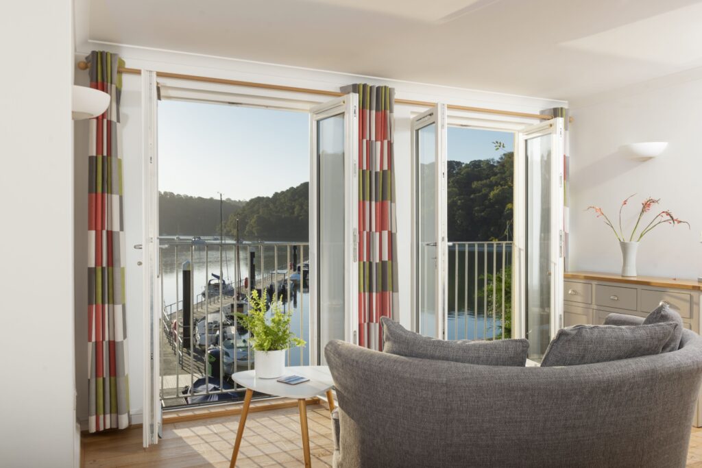
For more details, or to book, please contact Cornwall Hideaways on 01872 561642 or view their website here.
Launching and Lifting
Please contact the Harbour Office to book in a date and time for launching or lifting of any vessels on Lighterage Quay. Services are also provided at a number of other boatyards in the Fal Estuary.
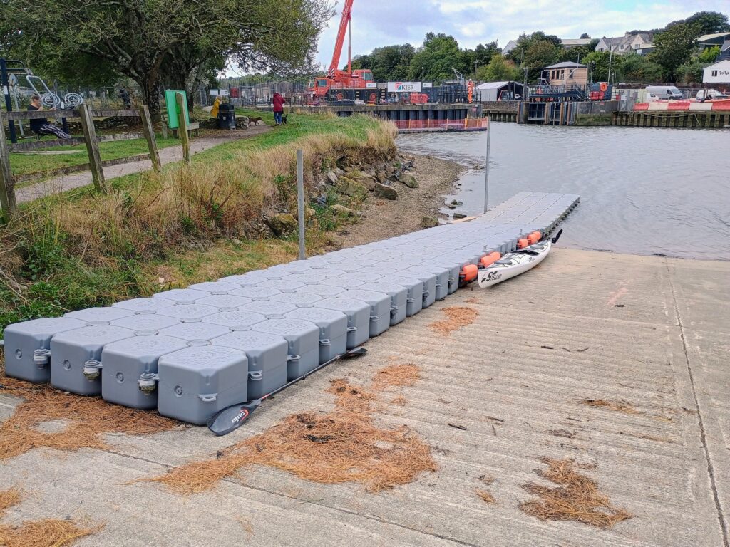
Slipways
Small craft can be launched from public slipways such as Mylor, Boscawen And Sunny Corner.
Water-ski’s and Jet Ski’s
There is a designated area for these activities and permits must be issued by either our Patrol Officers or by contacting the Harbour Office. Permits are available as a daily, weekly, monthly or annual permit, you can find the license form here.
Commercial
River Fal Commercial Moorings
The Port offers deep water sheltered lay-up berths for vessels up to 190m in length.

Lighterage Quay
350m of quay space with adjacent concrete hardstanding for storage and handling of goods. Waste disposal facilities are available on the quay, together with fresh water.
Heading north up the Carrick Road is a voyage to discovering the hidden delights of the Fal and Truro rivers. Unlike many rivers the passage to the head of navigation at Truro is mostly deep apart from the last few miles into the City where you can moor at Town Quay. You could take a leisurely few days exploring this area and still want to come back for more. A variety of mooring locations are available throughout the Estuary provided by Cornwall Council and a number of other operators. The entire Fal estuary holds approximately 4,500 moorings, 1500 of which are located within the Port of Truro.
Mylor creek hides behind the plethora of small craft moorings. Seasonal red/green lateral marks indicate the west going fairway through the moorings leading to Mylor Yacht Harbour, Mylor Yacht Club and Restronguet Sailing Club.
Continuing up North the entrance to Restronguet Creek lies to the west after Weir Point. The approach to Restronguet is relatively shallow and needs sufficient rise of tide to get into the deep water in the entrance of the creek which is marked by a host of small craft moorings. Moorings lead NW and the Pandora Inn sits on the western bank offering a long pontoon which dries at low water.
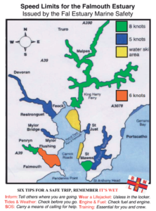
Continuing up Carrick Road, lateral buoys head NE and lead to Turnaware Bar green mark which keeps you clear of the bar stretching out from Tunaware Point. It also marks the start of the 8 knot speed limit and the start of the River Fal.
The deep water channel heads east for a couple of cables before turning north where you can find a row of large visitor mooring. River patrols are regularly undertaken of the visitor moorings and mooring or anchoring fees are collected. The Patrol boat crew are able to provide information and assistance to customers.
For the next two miles large mooring buoys are dotted along the channel providing sheltered mooring for large commercial vessels who make use of one of Britain’s deepest rivers. Just before the King Harry chain ferry there is a pontoon allowing access for the ferries and dinghies going to the National Trust Tressilick Gardens and House.
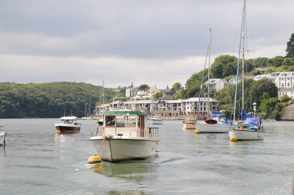
Contnuing to follow the main channel you will come to our marina at Malpas. The nearby Heron Inn serves food and drink and is easily accessed by dinghy.
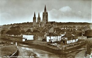
The river divides at Malpas with the Tresillian River heading off to the north east and the Truro River continuing South West as it rounds Victoria point on the northern bank. The channel winds its way upstream then narrows as it enters the canal like Lighterage Quay and Tidal Barrage with Truro Cathedral in the background.
The Truro Flood Barrier is usually open but it may be shut on exceptionally high tides, or during periods of heavy rain, to protect the city.
Once through the barrier, buoys give way to posts marking the channel at close intervals but be sure identify the next mark before heading to it. The channel hugs the starboard then port banks before being punctuated by a Supermarket on the port side. The river divides and the visitor moorings alongside the quay wall and harbour masters office can be seen ahead. Boats staying here for any length of time should be capable of taking the ground.
There are a number of passenger craft that operate within the Harbour, with a seasonal (April – October) service linking Falmouth to Truro. In addition, a number of ‘tripping’ and ferry boats use the area.
Water Ski and Jet Skis
Any personal Water Craft or Jet Skis require a permit to navigate in the port of Truro; Maritime bylaws for the protection & regulation of navigation within Truro Harbour and Penryn Harbour. Made under Section 83 of The Harbour Docks and Piers Clauses Act 1847 and The Truro & Penryn Harbour Orders.
Mariners are advised that byelaw 70 states :JET SKIS, JET BIKES ETC No person shall engage or take part in jet skiing etc. except with the written permission of the Harbour Master given either specifically or generally, and only in such areas as may be designated and in accordance with such reasonable conditions as may be imposed by the Harbour Master.
With reference to reasonable conditions, jet skis, jet bikes and Personal Water Craft may only launch from Mylor Yacht Harbour slipway and may only proceed to the water ski and jet ski area in Carrick Roads returning in a reciprocal manner. A permit is compulsory and available by contacting Truro Harbour office or the patrol vessel call sign ‘Carrick 2’ on Ch 12 VHF or mobile number 07483 332964. The license application form can be found on our Document Centre under Maritime Forms.
Wild Swimming
This is becoming very popular but before undertaking a personal risk assessment should be undertaken. Particular attention should be made of personal fitness for the swim and swim clothing appropriate for the time of year and water temperature.
Swimmers must consult tide tables and weather forecast before undertaking a swim to understand tidal flow or current that may be encountered and the size of any waves in open water.
Swimmers should NOT swim near navigational channels or fairways where they may encounter powered craft and not be seen.
Swimmers should use all possible methods to be seen by other water users. Wearing a bright swimming hat and towing a light weight hi-visibility float will help.
Kayaks and stand up paddle boards
These craft must comply with the ‘Collision Regulations’ as do other craft used or capable for transport on water. Paddle powered craft should exercise caution near navigational channels or fairways where they may encounter large powered craft and not be seen.
Paddle powered craft must not impede powered craft which cannot safely leave navigational channels or fairways.
When paddling at night these craft must exhibit a light.
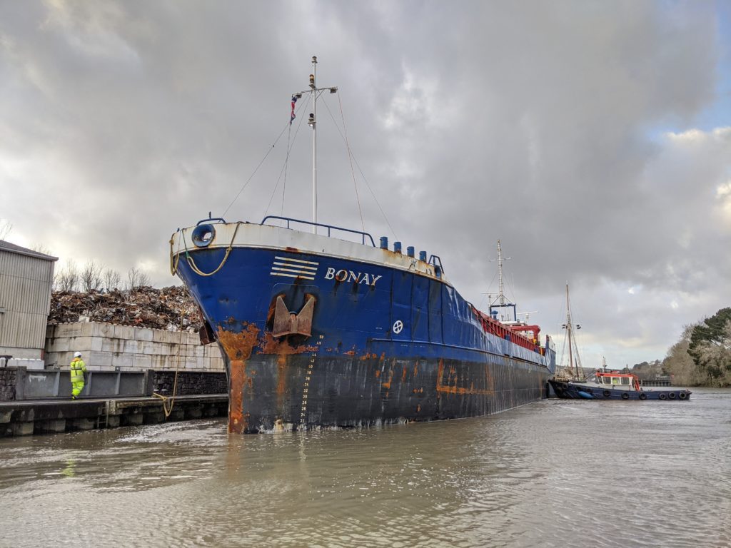
The natural deep water, sheltered moorings have historically been used for ships in lay up but we can offer short, or long term moorings. Our moorings are configures to facilitate vessels of various sizes, from 24 metres up to 190 metres length overall.
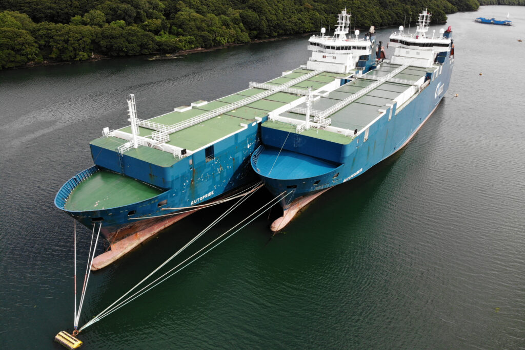
A full range of services are available from nearby Falmouth including engineering services, bunker supplies, fresh water, ship chandlers, towage and waste disposal.

Our River Fal Commercial Moorings offer:
- Secluded, safe deep water facilities
- Moorings for vessels up to 190m in length
- Short or long term options.
Lighterage Quay
At the heart of the port’s commercial activities is Lighterage Quay, located at the Newham Industrial area of the City.
A variety of cargoes have been handled through Lighterage Quay including sand, cement, scrap metal, building materials, animal feed, grain and fertilisers. The port has also welcomed project cargo in support of a variety of schemes both ashore and offshore.
Lighterage Quay is 350 metres in length and can also facilitate alongside lay up of suitably sized ships.