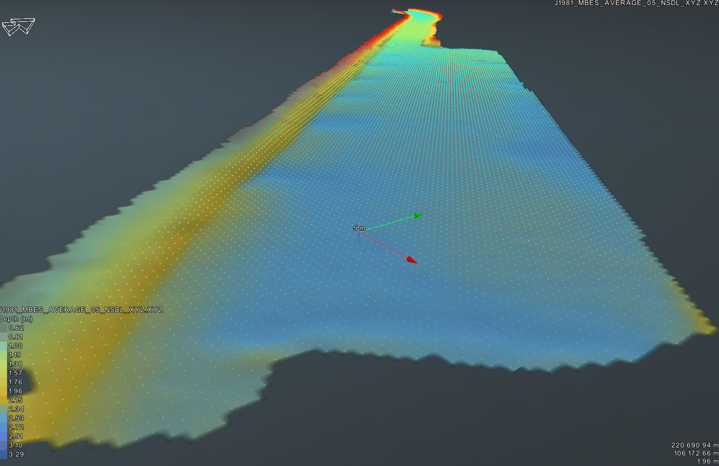
Multibeam bathymetric surveys have recently been completed at Bude and Penzance. These can be viewed in our Document Centre. Your attention is drawn to the ‘Notes’ on each survey which explains the datum (reference point) used in the survey. At Penzance the survey is to Chart Datum. In Bude the survey is the depth of water at ‘Normal Summer Dock Level’, this being 2.9m above the inner gate cill.

- Home
- About
- Our Harbours
- Main MenuMain MenuMain Menu
- Boat Licensing
- Contact